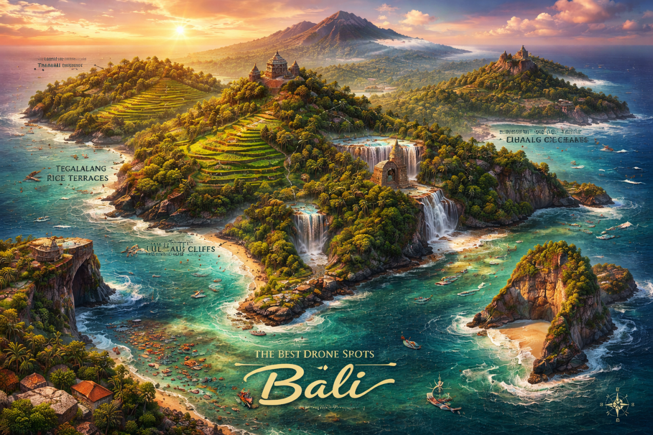
Bali is a place where rice terraces breathe like concertinas, where temples perch on cliffs as if on the edge of a dream, and where the ocean writes its own poetry in foam. For drone photographers, the island is both a generous muse and a mischievous teacher — offering sublime light, dramatic lines, and the gentle reminder that nature prefers to be admired with respect. Below is a curated tour of the island’s best aerial stages, woven with practical tips, folklore, and a pinch of wry traveler’s wisdom.
Before you launch: rules, ethics, and local good manners
Flying a drone in Bali requires more than technical skill; it demands cultural sensitivity. Many sacred sites and busy tourist areas restrict drones for reasons both practical and spiritual.
- Always check Indonesian aviation regulations and local signage before flying.
- Respect temple ceremonies, private property, and people’s privacy. When in doubt, don’t fly.
- Use quiet propellers and keep altitude moderate near villages and wildlife.
- Consider hiring a local guide or asking permission from landowners when shooting over terraces or private beaches.
With courtesy and care, your drone becomes a storyteller rather than a trespasser.
Uluwatu Peninsula — clifftop drama and sunset pyrotechnics
Uluwatu Temple (Pura Luhur Uluwatu) sits like a watchful elder above the Indian Ocean, and the cliffs nearby produce some of Bali’s most cinematic sunset frames.
- Best time: golden hour through blue hour; watch for surfers’ silhouettes.
- Composition tip: capture the curve of the shoreline, temple atop the cliff, and a lone fishing boat or surfer for scale.
You can search for it on Google Maps by typing: Pura Luhur Uluwatu
Note: Drone use can be restricted near the temple and in crowded beach spots. Scout permitted public beaches like Padang Padang Beach and watch wind conditions along the cliff.
Nusa Penida — otherworldly coastlines and Kelingking’s dinosaur ribs
Across a short strait from Bali, Nusa Penida’s coastline feels like a different planet. Kelingking Beach (often called Kelingking Cliff) offers that famous T-Rex silhouette; from the air, the head and tail form a dramatic shoreline curve.
- Best time: early morning for calmer seas and fewer boats.
- Composition tip: shoot wide to include the cliff, turquoise lagoon, and boats as tiny punctuation marks.
You can search for it on Google Maps by typing: Kelingking Beach, Nusa Penida
Flight caution: boat traffic and strong winds can complicate approaches. Keep safe distance from steep cliffs and nesting seabirds.
Tegallalang and Jatiluwih Rice Terraces — patterns stitched by human hands
Rice terraces are Bali’s hand-embroidered landscapes. Tegallalang Rice Terrace offers intimate lines and pathways, while Jatiluwih Rice Terraces (a UNESCO-listed landscape) spreads in grand, geometric sweeps.
- Best time: early morning mist or late afternoon when terraces glow. After harvest, terraces show different moods — plan around planting/harvesting cycles if you want water reflections.
- Composition tip: use higher altitudes for pattern shots; lower heights for paths and farmers to add human scale.
You can search for it on Google Maps by typing: Tegallalang Rice Terrace and Jatiluwih Rice Terrace
Respect the fields: don’t land on farming plots and ask permission before flying near workers.
Mount Batur and Lake Batur — caldera light and ash-dark silhouettes
Mount Batur’s sunrise hikes are legendary; from the air, the caldera rim, lake, and thermal springs form a palette of steam, shadow, and serenity.
- Best time: pre-dawn and sunrise to capture the first light over the caldera.
- Composition tip: make the lake’s circular shape your anchor, with ridgelines creating leading lines.
You can search for it on Google Maps by typing: Mount Batur and Lake Batur
Safety note: high altitude and morning winds can affect battery life — bring spares and monitor telemetry.
Lempuyang Temple and the “Gateway to Heaven” — mirrors and myth
Pura Lempuyang Luhur is famous for its photogenic gate frames. While many try for the reflective “mirror” images using a glass or phone, drones can reveal the temple’s relationship with the surrounding ridges and Mount Agung in the distance.
- Best time: early morning to avoid crowds and get slimmer cloud layers around Mount Agung.
- Composition tip: combine aerial angles that show the temple’s procession of gates receding toward the volcano for dramatic depth.
You can search for it on Google Maps by typing: Pura Lempuyang Luhur
Be mindful: the temple is sacred; flying directly above ceremonial gatherings is inappropriate.
Tanah Lot and sea temples — drama at high tide
Tanah Lot Temple (Pura Tanah Lot) appears to float at high tide, making it perfect for aerial shots that emphasize isolation and waves crashing against volcanic rock.
- Best time: sunset for golden light; high tide emphasizes the ‘island’ effect.
- Composition tip: frame the temple with swooping coastal lines and the foam of surf to convey motion.
You can search for it on Google Maps by typing: Pura Tanah Lot
Note: drone permissions are often restricted here, especially during sunset crowds and rituals.
Secret and lesser-known beaches — off-the-beaten-path gems
Bali’s quieter sands reward drone pilots who venture beyond the classic postcard spots. Consider beaches like Nyang Nyang Beach and Green Bowl Beach on the Bukit Peninsula for isolated cliffs, hidden coves, and dramatic staircases.
- Best time: early morning or weekdays to avoid crowds.
- Composition tip: vertical shots down cliff paths and surfers below give a thrilling sense of scale.
You can search for it on Google Maps by typing: Nyang Nyang Beach and Green Bowl Beach
Access often involves steep paths; wear good shoes and respect private property signs.
Waterfalls in central and north Bali — vertical drama and misty veils
Bali’s waterfalls — such as Tegenungan Waterfall, Sekumpul Waterfall, and Gitgit Waterfall — provide lush, vertical compositions. From the air, you can show the drop, the plunge pool, and the surrounding jungle in a single frame.
- Best time: after light rains when flow is generous but not dangerous.
- Composition tip: use a perpendicular descent to emphasize height, and avoid disturbing pools with landing or low passes.
You can search for it on Google Maps by typing: Tegenungan Waterfall, Sekumpul Waterfall, and Gitgit Waterfall
Respect safety: cliffs and slippery rocks make landing near waterfalls hazardous.
Sidemen Valley — quiet emerald quilts and local rhythms
Sidemen offers pastoral scenery reminiscent of a Balinese countryside painting: small rice plots, thatched homes, and distant ridgelines. For sustainable and intimate aerial work, this area is exemplary.
- Best time: golden hour and after rains when colors are saturated.
- Composition tip: look for narrow paths, ox carts, and farmers to punctuate the patterns.
You can search for it on Google Maps by typing: Sidemen, Bali
Engage locally: Sidemen has friendly villages; ask permission before filming near homes or ceremonies.
Nusa Dua and Benoa — modern coastlines and postcard clarity
If you prefer sharp lines, calm water, and modern marinas, Nusa Dua and Benoa Harbor provide clean, graphical compositions. The contrast between manicured resorts and natural shoreline can be compelling from above.
- Best time: mid-morning for crystal-clear water and visibility.
- Composition tip: use leading lines of piers and breakwaters to guide the eye.
You can search for it on Google Maps by typing: Nusa Dua and Benoa Harbour
Be mindful of restricted areas around marinas and private resorts.
Practical gear and settings for Bali’s light
Bali’s equatorial sun can be generous and brutal at once. Practical settings help you translate the island’s colors into photos that feel like memories rather than postcards.
- Use ND filters for long-exposure water shots and to keep shutter speeds balanced in bright light.
- Shoot in RAW to preserve shadow and highlight detail; Bali’s highlights (sand, waves) can blow out quickly.
- Bring spare batteries and a power bank. Heat and frequent launches drain systems faster than you expect.
- Keep prop guards handy and a small repair kit; coral sand, salt spray, and jungle branches are unkind companions.
Sustainable practices and community-minded shooting
Bali thrives when visitors leave things as they found them or better. Drone photographers can contribute positively.
- Share images with local communities and avoid monetizing shots of private property without consent.
- Support local guides, conservation initiatives, and cafes that practice sustainable tourism.
- Choose sunrise flights over late afternoons in sensitive bird-breeding seasons to minimize disturbance.
Final notes: the story beyond the shot
Aerial images are not just proof of a place’s beauty; they are maps of memory and culture. In Bali, every field, cliff, and temple has a story: a farmer’s quiet devotion, a fisherman’s patience, a priest’s chant at dawn. Fly lightly, frame thoughtfully, and let your images honor both craft and community.
If you want to find any location mentioned here on a map, you can search for it on Google Maps by typing the full place name provided in the sections above. Safe flights and clear skies — may your batteries be many and your landings forgiving.
Comments (0)
There are no comments here yet, you can be the first!